Uploading a 360 photo to Google Maps is free, but rejection often follows a failed resolution or horizon check. The image needs at least 4K resolution and smooth spherical stitching, with a full horizontal view rather than a conventional panoramic crop.
A property can look flawless on a laptop and still fail Google's checks. A real estate agent may have a bright living-room panorama, or a hotel marketer may have a carefully rendered lobby, yet the upload returns no useful explanation beyond a failure notice. The problem usually starts before the upload button, inside the exported file.
Google Maps treats 360 imagery as a spherical panorama. That means the file must preserve the complete horizontal field of view, carry the right metadata, and avoid defects that become obvious when the viewer wraps the image around a virtual viewpoint. The practical workflow is therefore simple: prepare a compliant file, inspect it, then publish it through the route that matches the project.
Table of Contents
- The Real Reason Your 360 Photo Gets Rejected
- Google Maps 360 Photo Requirements Explained
- Preparing and Exporting from VirtualTourEasy
- Uploading Your Photo to Street View Studio
- Choosing the Right Upload Method for Your Needs
- Troubleshooting Common Upload Errors
The Real Reason Your 360 Photo Gets Rejected
A rejection rarely means the scene looks unattractive. It usually means Google cannot interpret or display the file reliably as a spherical image. A panorama with a missing strip at the horizon, an incorrect projection, or insufficient detail can look acceptable in a standard image viewer while failing the Street View ingestion process.

The file matters more than the preview
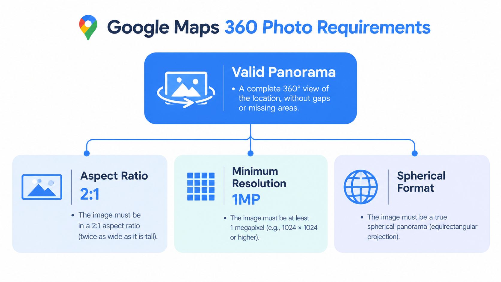
Google's acceptance process checks whether the image is a genuine full spherical panorama, not merely a wide photograph. The official requirements include a complete 360° horizontal sphere, Photo Sphere XMP metadata, a 2:1 aspect ratio, at least 7.5 MP, and a maximum file size of 75 MB. These rules are listed in Google's 360 photo requirements.
A common failure occurs when an export is cropped to fit a website banner or social media format. Another appears when stitching leaves a visible break at the horizon. Google allows minor gaps or holes between the top and bottom edges, but the horizontal wrap still needs to be continuous enough for the platform to project the scene correctly.
Practical rule: Treat the export as a map asset, not as a normal JPEG. A beautiful image with the wrong projection is still an invalid upload.
Why preparation saves time
A failed submission creates extra work because the original scene may need to be reopened, re-rendered, and re-exported. Checking the projection, dimensions, metadata, stitching, focus, and file weight before submission removes most avoidable trial and error.
Google's guidance also reflects the scale of the ecosystem. By 2022, Google reported more than 220 billion Street View images from over 100 countries and territories in the documentation linked through its contribution guidance. That mature system needs predictable files, which is why visual quality alone isn't enough.
Google Maps 360 Photo Requirements Explained
The acceptance rules become manageable once each requirement is connected to what the viewer needs. Google Maps doesn't display a 360 photo as a flat picture. It wraps an equirectangular image around a spherical viewing space, so the file's geometry controls whether the scene opens correctly.
The technical checklist
| Requirement | What it means in practice |
|---|---|
| Full horizontal sphere | The image must wrap through the complete horizontal view without a missing section. |
| 2:1 aspect ratio | A file measuring 3,840 × 1,920 pixels follows the expected equirectangular proportion. |
| Minimum resolution | Google lists at least 7.5 MP, with 3,840 × 1,920 pixels as the stated minimum in its support documentation. |
| File size | The upload must stay at or below 75 MB. |
| Photo Sphere XMP metadata | The metadata identifies the image as a spherical panorama for publishing. |
The resolution language can appear confusing because Google's contribution guidance also describes 4K as at least 3,840 × 2,160 pixels for 360 photos. For acceptance, the safer preparation choice is a high-resolution spherical export that preserves detail while maintaining the required 2:1 equirectangular format. The support page's explicit minimum is 3,840 × 1,920 pixels, so an export should never fall below that threshold.
Defects that trigger problems
A sharp, well-lit panorama can still fail if its stitching is visibly broken. Google advises avoiding significant stitching errors, motion blur, poor detail in shadows or highlights, and distracting effects around the nadir, the point directly below the virtual camera. Superimposed elements also need care. Google's newer guidance says overlays should appear only in the zenith or nadir region, not both, as explained in its current 360 imagery guidance.
Photo Sphere XMP metadata is another frequent blind spot. Renaming a file to suggest it is panoramic doesn't add the required tags. The export tool or workflow must write the metadata into the file so Google can identify its projection and treat it as a sphere.
Businesses that manage map visibility alongside media can also consult this practical resource on Google Business Profile management Australia. The profile and the image serve different purposes, but both benefit from accurate location information and consistent presentation.
Preparing and Exporting from VirtualTourEasy
VirtualTourEasy can be used as a preparation layer when a business starts with an existing 360 image, a regular photograph, or an AI-generated scene. The useful distinction is between making an image look panoramic and exporting a file that remains structurally suitable for Google Maps. The second task requires attention to projection, dimensions, metadata, and visual defects.
Start with the right scene format
Upload the existing panorama or create the scene inside the platform. A regular image can be transformed into a 360 scene, but the result still needs inspection at the seam, ceiling, floor, and viewing direction. A rendered property scene should be checked for warped furniture, duplicated edges, stretched text, and unnatural transitions before it's considered ready.
The export should use an equirectangular 2:1 layout. For a compliant baseline, select at least 3,840 × 1,920 pixels and keep the final file at or below 75 MB, following Google's published requirements. A higher-quality export can be useful when the source supports it, but increasing dimensions without checking the resulting file weight can create a second problem.
Export rule: Choose the highest practical spherical resolution, then verify both pixel dimensions and the final file size. One check without the other is incomplete.
Preserve the data Google needs
Metadata inclusion matters as much as the visible image. The export must retain Photo Sphere XMP metadata, because Google uses those tags to recognize the panorama as spherical imagery. A file that opens as a wide picture in a desktop viewer may still lack the information required for Street View publishing.
The workflow should also include a visual preview in a 360 viewer. Rotate through the seam, look straight up and down, and inspect areas where a logo, floor patch, or generated object might be superimposed. If the nadir contains a distracting tripod mark or a warped floor, correct it before publishing rather than hoping Google will conceal it.
For platform-specific guidance on balancing detail, dimensions, and compatibility, use VirtualTourEasy's image quality settings guide.
A preparation sequence that works
- Create or import the scene. Confirm that the source represents a spherical panorama rather than a cropped wide image.
- Select equirectangular output. Keep the required 2:1 relationship between width and height.
- Set the resolution deliberately. Use no less than 3,840 × 1,920 pixels for the accepted baseline.
- Enable spherical metadata. Confirm that Photo Sphere XMP information is included in the export.
- Inspect the full rotation. Check the horizon, seam, zenith, nadir, focus, and lighting.
- Check the file weight. Reduce unnecessary export overhead if the JPEG exceeds Google's limit, while preserving visible detail.
VirtualTourEasy can assemble scenes into a tour and support Google Street View publishing for eligible plans, but the file still needs to meet Google's ingestion requirements. The publishing connection doesn't remove the need for a valid panorama.
Uploading Your Photo to Street View Studio
Street View Studio is the practical desktop route for creators who need a controlled upload environment or have several files to manage. Google's contribution workflow supports multiple uploads and previews, which makes it more suitable than a phone-based process for property portfolios, hospitality venues, and repeat client work.
Upload and review the panorama
Open Street View Studio in a desktop browser and sign in to the Google account that should own the contribution. Choose the upload option, select the prepared 360 file or files, and wait for the preview to load. Don't submit immediately. The preview is the opportunity to catch an incorrect orientation, an obvious seam, or a panorama that Google has interpreted as a flat image.
The file's position and orientation affect how viewers encounter the scene. For a business interior, the starting direction should normally face a useful feature such as the reception desk, entrance, showroom, or main living area. A technically compliant image can still provide a poor first impression if the opening view points at a blank wall.
Handle location and connections carefully
Studio's structured workflow can associate imagery with a physical place and manage relationships between connected 360 photos. Google's publishing documentation describes metadata for position, orientation, connectivity, and publication status, which is important when a project contains several viewpoints rather than one isolated image. Connections may not appear immediately after publishing. Google notes that connections between individual 360 photos can take 4 days or longer to appear, and completed publishing may take several days, as described in the Street View Publish documentation.
Keep the original files and a record of the intended order until processing finishes. If a connection is missing, the creator can compare the published result with the planned path instead of rebuilding the entire project from memory.
A separate overview of Street View Studio workflows can help teams establish a repeatable process for uploads and reviews. For businesses focused on local discovery, this upload work fits alongside broader Data Hunters Agency local SEO practices, such as maintaining accurate listing information and useful media.
Studio versus a single-location contribution
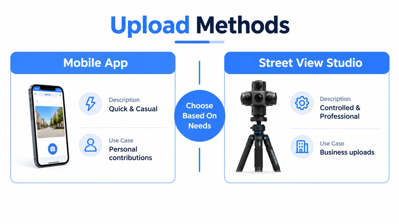
Street View Studio makes sense when the creator needs desktop controls, batch selection, or a repeatable client process. The Google Maps mobile app is more convenient for a single contribution attached to a specific location, but it offers less operational control for a large set of prepared scenes.
After submission, allow Google's processing to finish before judging the result. A file that doesn't appear instantly isn't necessarily rejected, while a visible failure after processing usually points back to the export checks covered earlier.
Choosing the Right Upload Method for Your Needs
The right route depends on the size and purpose of the contribution. A restaurant owner adding one updated interior view has a different need from a hospitality team preparing a connected property tour.
| Situation | Better starting point | Why |
|---|---|---|
| One panorama for a known business location | Google Maps mobile app | It suits a quick, location-specific contribution. |
| Several prepared panoramas | Street View Studio | Desktop selection and preview make review easier. |
| Repeated publishing for managed locations | Studio or API workflow | Structured metadata and status management support operational consistency. |
| A complete interactive tour | Tour platform plus Street View publishing | The map version can provide discovery while the hosted tour handles richer navigation. |
The mobile route works best when speed matters more than batch control. The contributor selects the relevant location in Google Maps, adds media, and chooses the 360 image from the device. It's a practical choice for a single update, but it doesn't replace a quality-control process.
Street View Studio is the stronger choice for professional contributors who need to review multiple assets and manage placement. The Street View publishing guide gives additional context for creators deciding how a mapped contribution fits into a broader virtual tour workflow.
The API is a different category again. Google's Street View Publish API is designed for applications that publish imagery with position, orientation, connectivity, and status metadata. It's appropriate for structured, repeatable operations, not for someone uploading one panorama after a property shoot.
Troubleshooting Common Upload Errors
Start with the symptom, then test four areas in order: projection, dimensions, metadata, and file weight. This sequence prevents random re-exports and points to the correction most likely to resolve the rejection.
If the panorama opens as a flat image or Google fails to identify it as spherical, inspect the projection and Photo Sphere XMP metadata. A broken wrap, duplicated edge, or mismatched horizon indicates a stitching problem in the source file. Repair the stitch and export again instead of cropping the panorama. Minor imperfections may pass review, while major geometry errors can block acceptance.
Check the export dimensions next. Confirm at least 3,840 × 1,920 pixels, a 2:1 aspect ratio, and the stated 7.5 MP minimum. Keep the final file at or below 75 MB, following Google's 360 imagery guidance.
Diagnostic order: Check projection first, dimensions second, metadata third, and file weight fourth. Each failure has a different cause, so changing settings at random wastes time.
Blur, weak shadow detail, and distracting nadir artifacts stem from source-quality issues. Correct them during export before resubmitting. If compression is required, reduce unnecessary export overhead while checking fine details, seams, and dark areas again. The guidance on file upload limits for creators offers general context, but Google's limit controls this workflow.
Open the corrected file in a 360 preview before uploading. After acceptance, retain that export as the project master for future edits or publishing.
Virtual Tour Easy lets real estate, hospitality, and other space-based businesses create 360 scenes, assemble virtual tours, and publish eligible tours to Google Street View within one workflow. Visit Virtual Tour Easy to prepare a compliant panorama and build the surrounding tour experience.